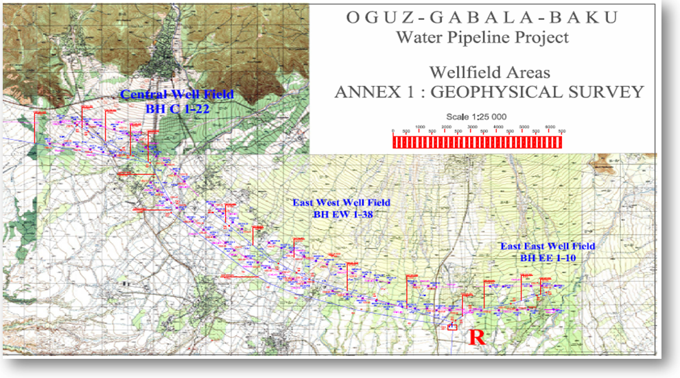
Airborne Detection of Groundwater Aquifers
Groundwater often does not devote much attention from economical point of view, although it is one of the most important assets for every country.
With the help of the new AQUASCAN technique the groundwater and their productivity potential can be explored and imaged in a depth till 500m in a fast and cost-effective way by helicopter.
![]()
Groundwater exploration by helicopter-borne
seismo-electromagnetics
Method
AQUASCAN is a proprietary helicopter-borne passive seismo-electromagnetic system which measure and analysis specific power spectra.
It is used to detect transmissible acquifers which are exhibiting increased signals as compared to dry and tight softground and hard rock (acquitards, acquicludes).
Case Example - Glacial Groundwater Channels
In the greater Elmshorn area in Northern Germany a helicopter-borne AQUASCAN survey was carried out.
Main target was the detection and mapping of subsurface glacial channels which cutted up to 300m deep into the tertiary stratum and sediments up to 50m thickness.
These hollow molds have been filled by sand and gravel exhibiting excellent transmissibility (high permeability and acquifer thickness) and productivity potential.
The obtained anomaly pattern of increased signal power clearly indicates and delineates the groundwater aquifer extensions.
Glacial Groundwater Channels
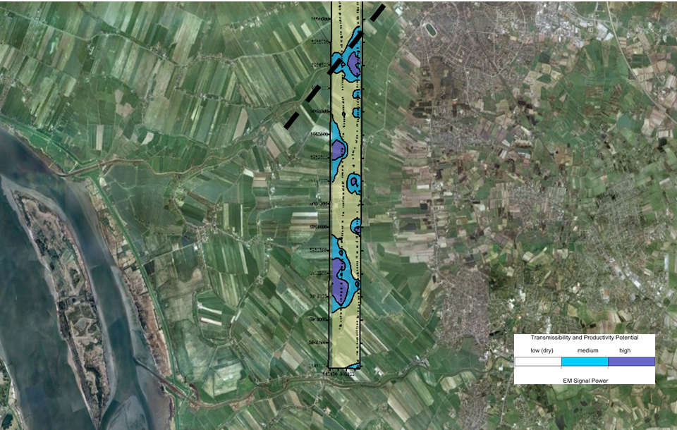
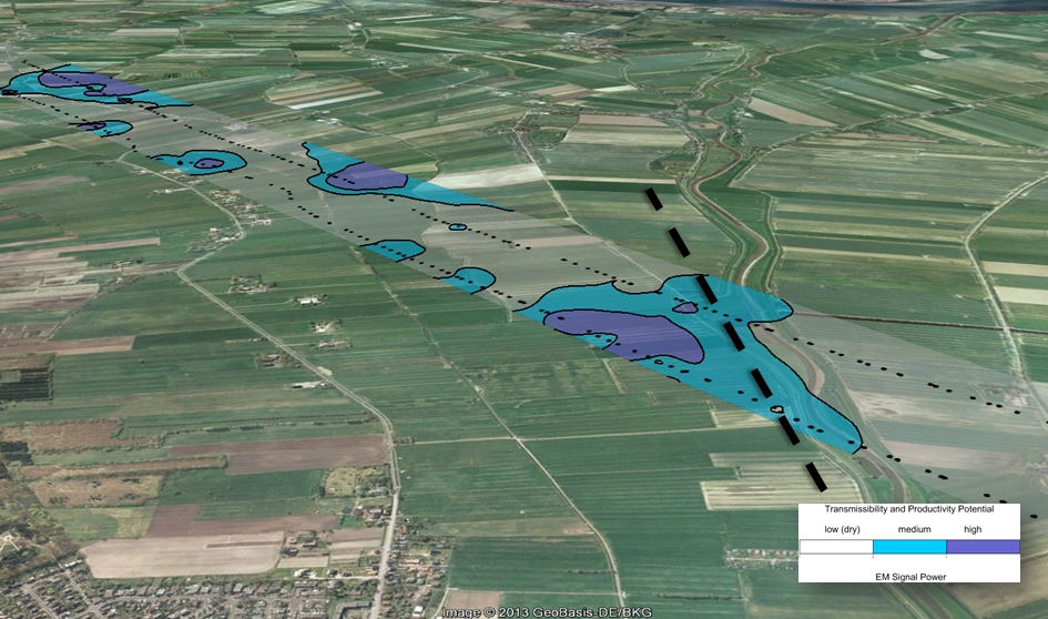
Results in parts of the investigation area