Case Examples
In order to prove the economic feasibility for exploitation of ore mineral resources in an acreage in Northern Germany an ORESCAN exploration survey were carried out.
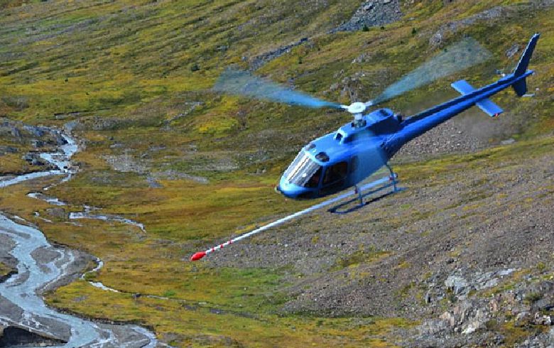
Since 2012 several helicopter-borne surveys for detection and 3D imaging of ore deposits were performed in rough terrain in the Canadian Rocky Mountains
![]()
Helicopter-borne survey in Germany has clearly identified ore minerals and iheir distribution
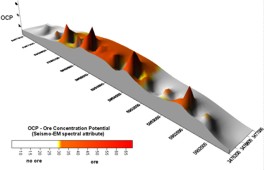
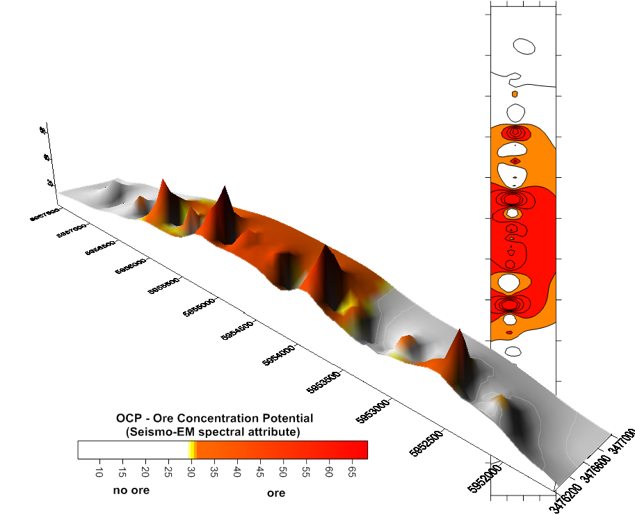
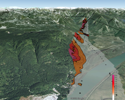
Distribution of seismo-EM attribute OCP
(Ore Concentration Potential) indicating extension and accumulation zones of heavy mineral placers
In co-operation with the well established Canadian specialist Precision GeoSurveys several helicopter-borne multi sensor surveys were performed since 2012.
Main task is to demonstrate the direct detection ability of ORESCAN method and thus supporting conventional Airborne Geophysics for an entry into the Canadian mining market.
Helicopter Survey in Northern Germany
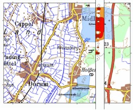
A large area around the villages Midlum and Dorum in Northern Germany is prospective to find heavy mineral placers. The general ore-presence was discovered locally by chance during a drilling campaign for groundwater exploration. The ore minerals are consisting mainly of ilmenite and rutile in varying concentrations within a 4 to 8 m thick sand layer in a depth of about 50 m.
In order to prove the economic feasibility for exploitation of these mineral resources further detailed geophysical explorations were carried out. In the Figure the results of a helicopter-borne seismo-electromagnetic ORESCAN survey within a part of the concession area are represented.
From data acquisition and data processing the distribution of the seismo-EM spectral attribute OCP (Ore Concentration Potential) is obtained.
The geophysical measuring result allows the following threefold geological conclusions:
![]() Threshold-exceeding OCP-values are verifying
that the sensitivity of the system was excellent
to detect the ore occurrence, even though
only semi-conductive ore minerals are present
Threshold-exceeding OCP-values are verifying
that the sensitivity of the system was excellent
to detect the ore occurrence, even though
only semi-conductive ore minerals are present
![]() A continuous level of increased OCP indicates
and maps the field extent of the heavy mineral
ore deposit
A continuous level of increased OCP indicates
and maps the field extent of the heavy mineral
ore deposit
![]() Single OCP anomaly peaks within the ore deposit
field are indicating local zones of increased
ore accumulations
Single OCP anomaly peaks within the ore deposit
field are indicating local zones of increased
ore accumulations
ORESCAN Surveys by Helicopter in Canada
e.g. partial results:
Lateral Resolution of EM signals indicates ore accumulations
in rough terrain at the Rocky Mountains
Deliverables
Data acquisition (helicopter-borne):
![]() Continuous automatically measurement of the electromagnetic field
Continuous automatically measurement of the electromagnetic field
![]() Low and slow survey flights
Low and slow survey flights
![]() Survey line spacing 50 to 100m
Survey line spacing 50 to 100m
Data processing:
![]() Signal analysis
Signal analysis
![]() 3D inverse modeling
3D inverse modeling
Data evaluation and visualisation:
![]() Overlay contour plots comprising 3D informationen about depth and source signal intensity distribution
Overlay contour plots comprising 3D informationen about depth and source signal intensity distribution
![]() 2D and 3D visualisation of results
2D and 3D visualisation of results
Final report:
![]() Geological interpretation of geophysical results referring the ore/graphite occurence potential with depth estimation
Geological interpretation of geophysical results referring the ore/graphite occurence potential with depth estimation
Advantages & Features

![]() Efficient de-risking tool
Efficient de-risking tool
![]() Differentiation between presence or absence of metallic ore and graphite deposits
Differentiation between presence or absence of metallic ore and graphite deposits
![]() No geographical / surface / infrastructure
No geographical / surface / infrastructure
related constraints
![]() No environmental limitations
No environmental limitations
![]() No need for ground permitting
No need for ground permitting
![]() Quick turn-around
Quick turn-around
from preparation through data acquisition and processing to result
delivery with final report
About us
![]() GEO EXPLORATION TECHNOLOGIES - GET - is a German geophysical service company experienced in exploration of subsurface resources, structures and properties serving numerous national and international projects since 1986.
GEO EXPLORATION TECHNOLOGIES - GET - is a German geophysical service company experienced in exploration of subsurface resources, structures and properties serving numerous national and international projects since 1986.
![]()